Thumbnails on one page
Part 1: West and South Coasts:
Part 2: Northeast Coast and Cape Breton Island:
Digby | Liverpool | St.
Margarets
Inverness | Bay St. Lawrence | Baddeck | Louisbourg
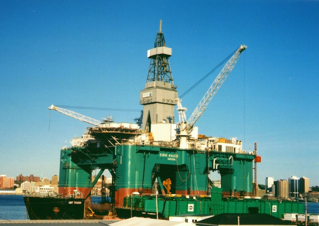
This is about my travels around Nova Scotia. I was there from the end of April to July, 2002, to work on the semi-submersible drilling rig, the Bingo 9000-2, "Eirik Raude". I spent most my time in Dartmouth, as I was working 12 hour night shifts, but I did manage two trips, one to the south coast on the May long weekend, and the other to Cape Breton after I completed work on July 12.
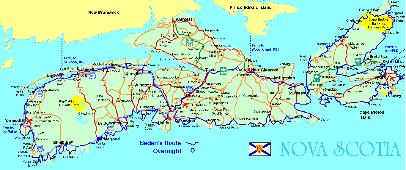
This is a map with my routes traced in dark blue:
Part 1: West and South Coasts
On the Victoria day long weekend. I slept a few hours on Saturday morning, then I got up, packed,
and went over to the Budget car rental place where I rented a Neon. I then drove out of Dartmouth
to highway 101 over to Windsor, near the Bay of Fundy. From then on, I stayed on the scenic
route as much as possible, as the main highway was pretty ugly, with nothing really to see.
Along the Avon River, I could see where the high tides left mostly mud flats, and then I went past Mount Allison University, which was way out in the sticks. Shortly thereafter, I cruised into Kentville, which was a very picturesque place, and stopped for lunch at an excellent downtown restaurant. One thing about Nova Scotia, they were in love with malls and big box retailers, which had really decimated all the downtown commercial districts.
 After lunch, I drove in the rain down some country roads, and then onto Highway 1 through the
Annapolis Valley. The valley was very nice, and many apple trees were flowering. Most the people I
saw were mowing their grass. I could see that there were many hobby farms, as most houses had
Volvos in front and a plethora of new John Deer equipment out back. By about 18:00, I was in Digby,
so I drove around, then I got a motel for the night. The place was barren, without anybody on the
street, and most the restaurants were closed. Considering that it was a Saturday night on the May
long weekend, I thought it was odd, and apparently, they don't travel around much down there. I
then went out for supper, and ordered Digby scallops. I thought I would get twice as much, for half
the price, instead I got half as much for twice the price ($17). As with most nice restaurants
around there, they were priced for U.S.A. tourists.
After lunch, I drove in the rain down some country roads, and then onto Highway 1 through the
Annapolis Valley. The valley was very nice, and many apple trees were flowering. Most the people I
saw were mowing their grass. I could see that there were many hobby farms, as most houses had
Volvos in front and a plethora of new John Deer equipment out back. By about 18:00, I was in Digby,
so I drove around, then I got a motel for the night. The place was barren, without anybody on the
street, and most the restaurants were closed. Considering that it was a Saturday night on the May
long weekend, I thought it was odd, and apparently, they don't travel around much down there. I
then went out for supper, and ordered Digby scallops. I thought I would get twice as much, for half
the price, instead I got half as much for twice the price ($17). As with most nice restaurants
around there, they were priced for U.S.A. tourists.
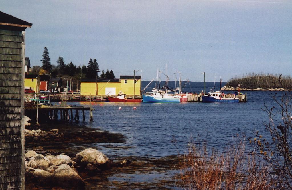
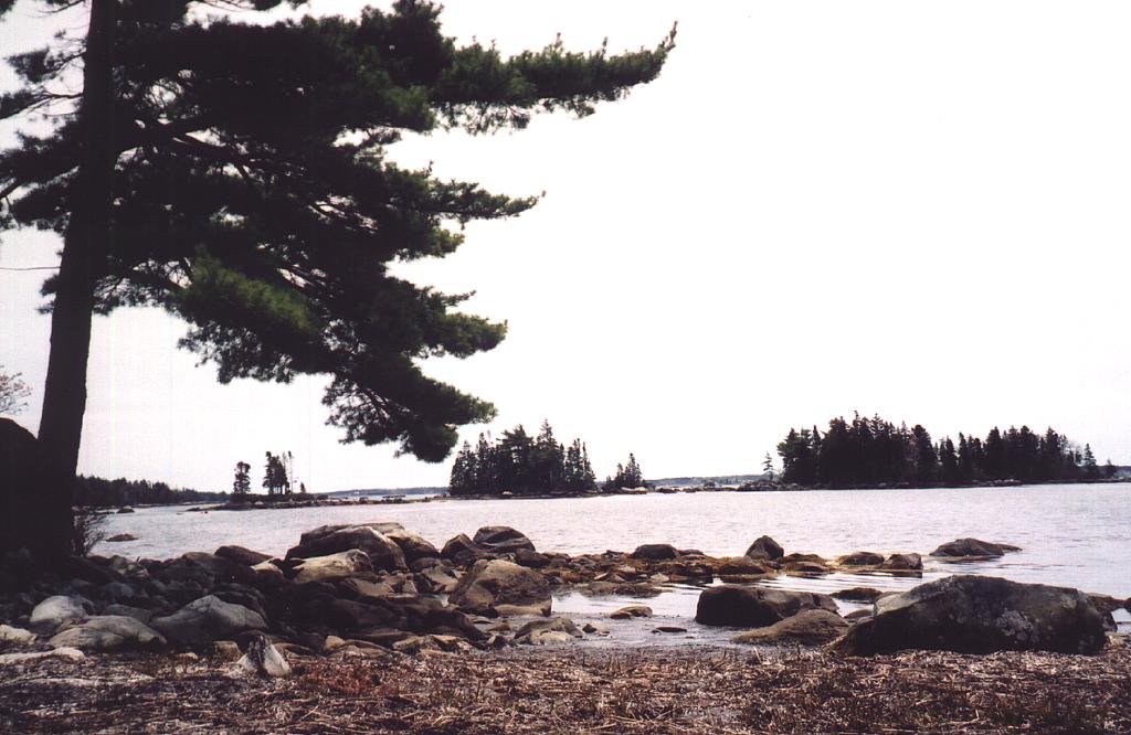
In the morning, the rain had stopped, and I walked around the town and the wharf. I watched some buddies unloading some ugly stone cod fish off their boat, and I took some neat photos of the local fleet and town. I then traveled on down the coast through mostly French Acadian territory to Yarmouth, which was a rather uninspiring place. The coast in general was not what I expected, as it looked more like Canadian Shield with poor drainage, and many swamps and stunted trees.
 I then drove on along the coast, and went over the Barrington Causeway to the most southerly road in
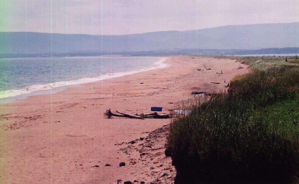
the province, near Cape Sable. There was a really nice beach there, probably the nicest among the
few I saw on the whole trip, but it was cool and windy. After driving for a bit more, and then
through Shelburne, where I was contemplating stopping for the night, I continued on, after filling
up with gas (45L for 600km), to Liverpool, where I got a room in the Lane's
Inn, which was a
I then drove on along the coast, and went over the Barrington Causeway to the most southerly road in
the province, near Cape Sable. There was a really nice beach there, probably the nicest among the
few I saw on the whole trip, but it was cool and windy. After driving for a bit more, and then
through Shelburne, where I was contemplating stopping for the night, I continued on, after filling
up with gas (45L for 600km), to Liverpool, where I got a room in the Lane's
Inn, which was a
 beautifully restored old Inn right on a lake on the Mersey River. After a little nap, I had dinner
in the bar there, as most restaurants close even earlier than Vancouver. There was a big play
festival on in Liverpool that weekend, and even the Governess General attended. There were also six
single women, three slim ones which was a rarity there, at the bar when I came in, and
three later. I guess they went there for some kinky P&Q.
beautifully restored old Inn right on a lake on the Mersey River. After a little nap, I had dinner
in the bar there, as most restaurants close even earlier than Vancouver. There was a big play
festival on in Liverpool that weekend, and even the Governess General attended. There were also six
single women, three slim ones which was a rarity there, at the bar when I came in, and
three later. I guess they went there for some kinky P&Q.
 After a great French toast breakfast, I continued on up the coast. I thought that since there were
only about 100 km to Halifax, that I would be finished my trip soon, however I was dead wrong, as it
took a full day's drive to get from Liverpool to St. Margarets Bay. As I drove along the coast, I
stopped at a beautiful long beach along a causeway to Cape LeHave Island. The island was also
picturesque, but when I tried to photograph a heron right beside my car, it as usual, took off. I
never seem to be able to get close to those big birds. {:-(
After a great French toast breakfast, I continued on up the coast. I thought that since there were
only about 100 km to Halifax, that I would be finished my trip soon, however I was dead wrong, as it
took a full day's drive to get from Liverpool to St. Margarets Bay. As I drove along the coast, I
stopped at a beautiful long beach along a causeway to Cape LeHave Island. The island was also
picturesque, but when I tried to photograph a heron right beside my car, it as usual, took off. I
never seem to be able to get close to those big birds. {:-(
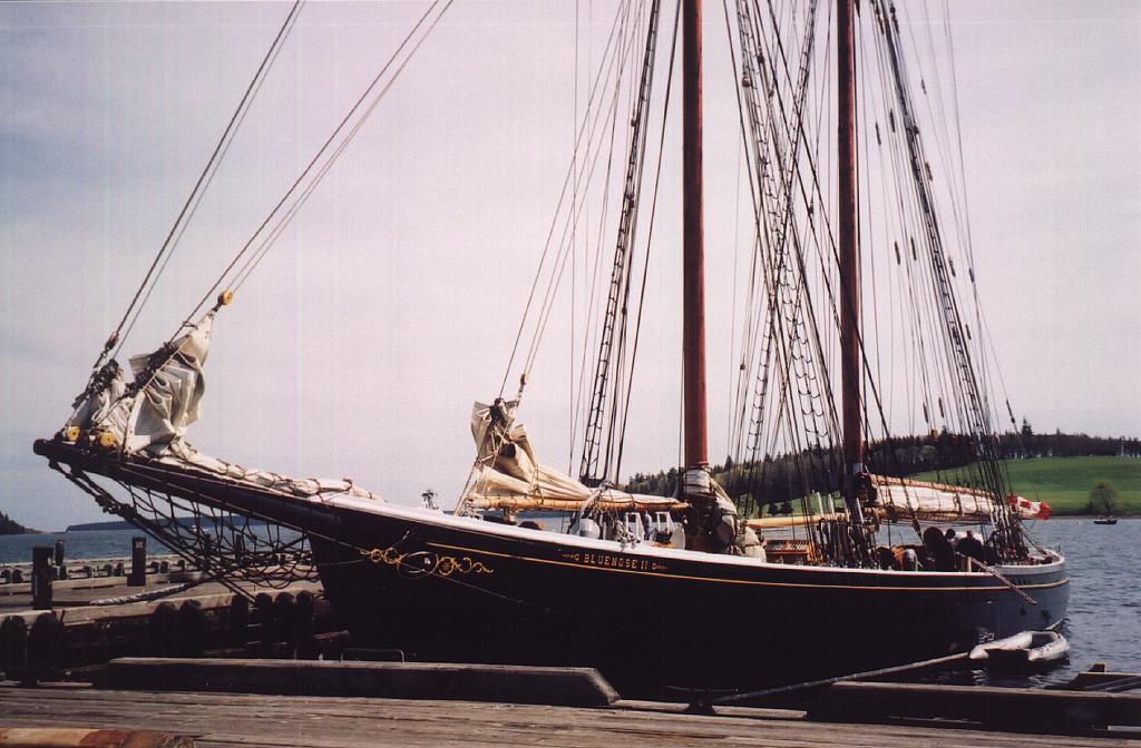 Afterwards, I drove up the bay to Bridgewater, where they had a large warship docked. It was
almost as much out of character as the big ugly mall. After a short drive, I entered Lunenburg, and
walked around there. The town was very beautiful, with many vintage buildings, and the Bluenose II
was also docked there. I took a nice picture, but I couldn't get the full boat, as ugly power wires
obstructed the view. I could not understand why they would let power wires run through a world
famous tourist spot.
Afterwards, I drove up the bay to Bridgewater, where they had a large warship docked. It was
almost as much out of character as the big ugly mall. After a short drive, I entered Lunenburg, and
walked around there. The town was very beautiful, with many vintage buildings, and the Bluenose II
was also docked there. I took a nice picture, but I couldn't get the full boat, as ugly power wires
obstructed the view. I could not understand why they would let power wires run through a world
famous tourist spot.
 I then drove on to Mahone Bay, which had more churches than streets. Actually, If I got five
dollars for every church I saw, it would had well paid for the whole trip. The province was just
full of churches, most of them in good condition.
I then drove on to Mahone Bay, which had more churches than streets. Actually, If I got five
dollars for every church I saw, it would had well paid for the whole trip. The province was just
full of churches, most of them in good condition.
 When I reached Hubbards, I called my friend JB, and he invited me to stay
at their place for the night, so I first stopped for supper, and had a big delicious plate of
mussels, followed by salmon, then I went and stayed at the Breslins for the night. I knew JB from
Ft. St. John, as he was first my boss back in 1988, and they retired in Nova Scotia about five
years ago. They had a really nice new spread right on the water, which they were landscaping.
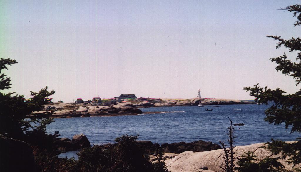
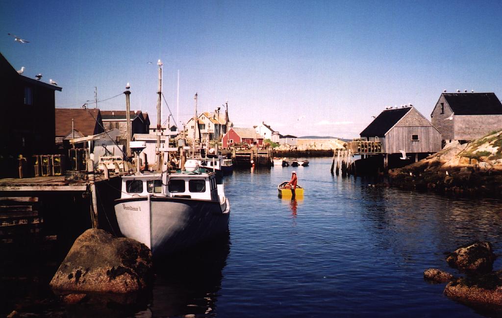
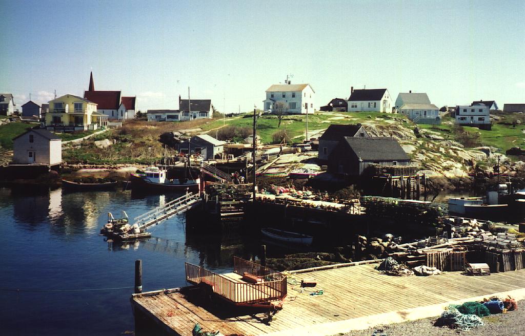
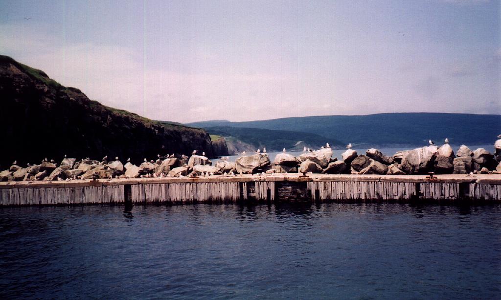
Tuesday morning, I headed out to Peggy's Cove. There was not a cloud in the sky, and the scenery
really was fine. The harbour itself couldn't be any smaller and still have boats in it. I also
took some cove photos from near the Swissair memorial. JB had heard the crash into the sea, as it
was fairly loud. The day after, they were stopped by the army from going near the shore at a
property they were looking at, as the army was collecting body parts. After Peggy's Cove, I headed
back around Halifax, dropped off my car at Budget ($127), and checked into the motel at about 13:00
for a few hours sleep before work.
When I reached Hubbards, I called my friend JB, and he invited me to stay
at their place for the night, so I first stopped for supper, and had a big delicious plate of
mussels, followed by salmon, then I went and stayed at the Breslins for the night. I knew JB from
Ft. St. John, as he was first my boss back in 1988, and they retired in Nova Scotia about five
years ago. They had a really nice new spread right on the water, which they were landscaping.
Tuesday morning, I headed out to Peggy's Cove. There was not a cloud in the sky, and the scenery
really was fine. The harbour itself couldn't be any smaller and still have boats in it. I also
took some cove photos from near the Swissair memorial. JB had heard the crash into the sea, as it
was fairly loud. The day after, they were stopped by the army from going near the shore at a
property they were looking at, as the army was collecting body parts. After Peggy's Cove, I headed
back around Halifax, dropped off my car at Budget ($127), and checked into the motel at about 13:00
for a few hours sleep before work.
| Peggy' s Cove | |||
 |
 |
 |
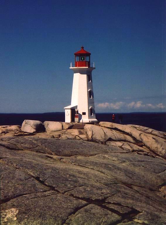 |
Part 2: Northeast Coast and Cape Breton Island

 I started out on a beautiful and sunny Saturday, July 13, morning at about 11:45, driving my new
Honda Civic from Budget down to near the water in Dartmouth, where I had been working for the
previous 11 weeks, and then turned left, going past the ESSO refinery. After a bit, I turned left
with the centre lines up Cow Bay Road, and then a short while later, I decided that the road wasn't
taking me in the correct direction, so I turned around, and went back down another road to the
seashore, which I drove along for another short bit, only to come to a dead end at a golf course. I
then returned over the route I had just taken back onto Cow Bay Road, and told myself that it sure
wasn't a very good start!
I started out on a beautiful and sunny Saturday, July 13, morning at about 11:45, driving my new
Honda Civic from Budget down to near the water in Dartmouth, where I had been working for the
previous 11 weeks, and then turned left, going past the ESSO refinery. After a bit, I turned left
with the centre lines up Cow Bay Road, and then a short while later, I decided that the road wasn't
taking me in the correct direction, so I turned around, and went back down another road to the
seashore, which I drove along for another short bit, only to come to a dead end at a golf course. I
then returned over the route I had just taken back onto Cow Bay Road, and told myself that it sure
wasn't a very good start!
I took another wrong, but interesting, way a short while later, as I ended up by a big lagoon and
Rainbow Haven Provincial Park. After setting myself straight again, I drove back though Cole
Harbour, and I was on my way up the coast. I passed a big, albeit windy, beach at Lawrencetown,
where there were quite a few people in wet suits, possibly surfing, although the waves weren't that
big. After following the road along the coast some more, I turned off to go visit Clam Harbour
Beach. The beach looked very nice, but I could see the fog forming off the land so I knew that the
water wasn't very warm, a fact that was confirmed by the lifeguard's sign, "Air 20, Water 11". I
knew then that I wouldn't be personally verifying the water temperature. ![]()
 Back in the car, I headed off, only to stop a short while later and take some pictures of lupins,
and then roses by the shore at a little fish plant corner called Owl's Head. All the flowers seemed
to be in full bloom, and the wild roses were especially beautiful. They were much bigger and had
deeper colour than our western ones. After cruising through Sheet Harbour, Moosehead, and Ecum
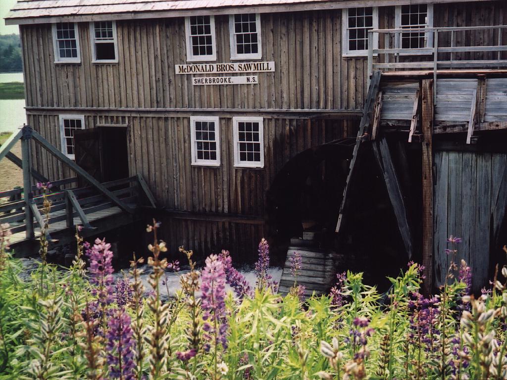
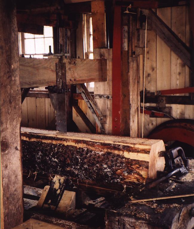
Secum, I then stopped at Sherbrooke, which had an olde restored operational village. I decided
against touring all the buildings, as I didn't really have the time, and I thought it wouldn't be
that interesting anyway, but I did stop to check out the sawmill a short bit later. The sawmill was
powered by a big water wheel, which was connected to a big pulley system in the basement, and then
to a big reciprocating saw upstairs. It was fully operational, and I was very impressed, not only
by all the old gear in operation, but also by the very straight cuts down whole log. The sawman
said that the mill would cut up four logs a day into what looked like about 40 mm boards. He also
told me that he would change saws about every two days. The sawmill was basically all automatic,
the drive system also powered sawdust and trim conveyor chains, and the log haul from the pond
in front of the mill. After Sherbrooke, I continued on a gravel country road along the coast, which
then rejoined the main road, and followed up the coast .
Back in the car, I headed off, only to stop a short while later and take some pictures of lupins,
and then roses by the shore at a little fish plant corner called Owl's Head. All the flowers seemed
to be in full bloom, and the wild roses were especially beautiful. They were much bigger and had
deeper colour than our western ones. After cruising through Sheet Harbour, Moosehead, and Ecum
Secum, I then stopped at Sherbrooke, which had an olde restored operational village. I decided
against touring all the buildings, as I didn't really have the time, and I thought it wouldn't be
that interesting anyway, but I did stop to check out the sawmill a short bit later. The sawmill was
powered by a big water wheel, which was connected to a big pulley system in the basement, and then
to a big reciprocating saw upstairs. It was fully operational, and I was very impressed, not only
by all the old gear in operation, but also by the very straight cuts down whole log. The sawman
said that the mill would cut up four logs a day into what looked like about 40 mm boards. He also
told me that he would change saws about every two days. The sawmill was basically all automatic,
the drive system also powered sawdust and trim conveyor chains, and the log haul from the pond
in front of the mill. After Sherbrooke, I continued on a gravel country road along the coast, which
then rejoined the main road, and followed up the coast .
I then realised that I would have a ferry to cross, and the ferry sign indicated that the Country Harbour Ferry left at a quarter past and a quarter to the hour. As it was already 4:12, I realised that I would probably miss it, and sure enough, when I got to the ferry landing, the ferry had just left. As it was hot and sunny out, I got out of my car, took my shirt off, and went for a little stroll around the locale. I then decided to leave a pee in the ditch which turned out to be a big mistake. All of a sudden there were a whole bunch of little mosquito sized flies all around me, which I never thought too much of, until I noticed a big pool of blood on my arm. It turned out that the bugs I thought were innocuous, instead were my first experience with big blood sucking black flies. I am still suffering the effects from the approximately ten bites I received in 30 seconds.
After departing from the ferry on the other side of the inlet, I drove up the road, around through Goldboro, and then took a side trip up to the Goldboro Gas Plant, which was completed a few years ago to process the Sable Island gas field. The plant was rather isolated and deserted looking, so I just read the information signs, and then left. I noticed that the inlet flanges were huge, so I imagined that the line pressures were very high.
 After Goldboro, the countryside was again very uninspiring, except for locations such as Larry's
River, which provided some unique scenery. After that, the road joined the main road to Canso,
which was under construction and graveled for several kilometres. The countryside along the north
coast through Guysborough was more more scenic and pastoral, especially compared to much of the east
coast's bog and boreal forest.
After Goldboro, the countryside was again very uninspiring, except for locations such as Larry's
River, which provided some unique scenery. After that, the road joined the main road to Canso,
which was under construction and graveled for several kilometres. The countryside along the north
coast through Guysborough was more more scenic and pastoral, especially compared to much of the east
coast's bog and boreal forest.
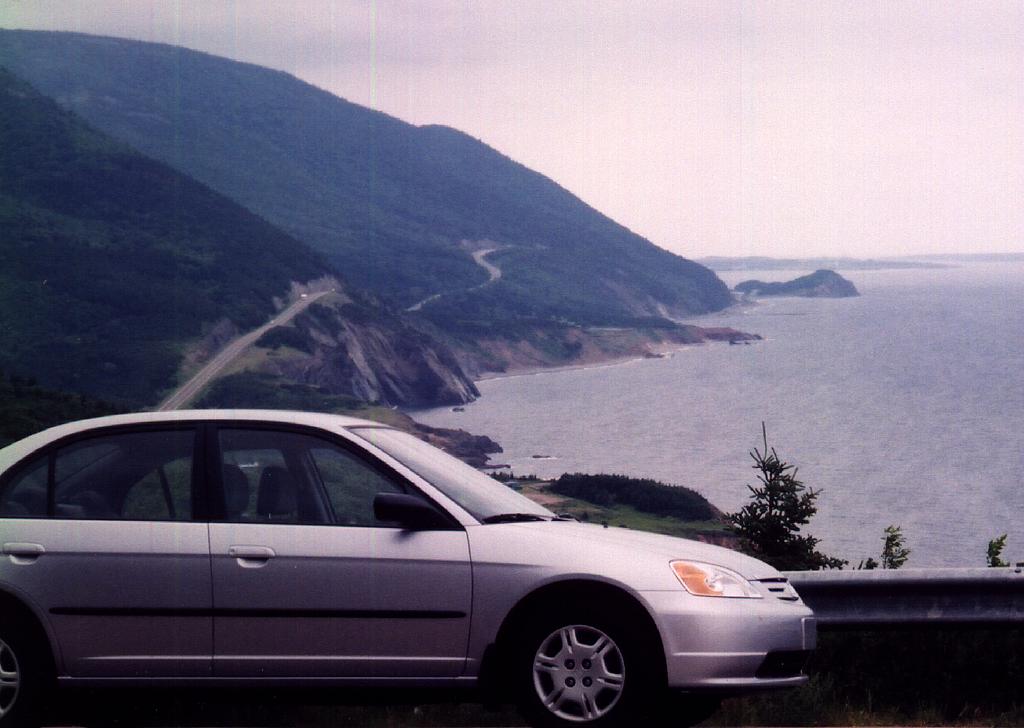
I took the north road, up along the Canso Straight, which was rather interesting, as it was an industrial hub. There were several ships tied up, and across the straight, not far at all, were the industrial centres of Point Tupper and Port Hawkesbury, which had the Sable fractionation plant and the Stora pulp and paper mill. A short time later, after descending a huge hill, the Canso Causeway came into view, and I crossed it onto Cape Breton Island. Once on the island, I head up the west coast, as I figured that since the weather was forecast to be worse on Monday, I would be better off to see the scenic parts, including the Cabot Trail, on Sunday.
The highway from Port Hastings at the north end of the Canso Causeway along the west coast was wide, straight, and uninspiring. I figured that I would only drive about an hour or so, as it was getting late and I was getting tired, but there were not any motels. I finally pulled in at Port Hood, but the town was rather small, and the only motel looked run-down, so after a short jaunt through the town, I continued up the coast with Inverness as my destination for the night.
After driving through some nice rural valleys, past the Glenora single malt distillery, and skirting Lake Ainslie, I ended up in Inverness for about 470 km on the day. I thought that there would be a sizable tourist infrastructure, but once again I was wrong. One motel was full, and the other one only had one room left, so I got the last room in town at 20:30. I was considering going out to the pub on the Saturday night, but being smoked out the night before in the hotel pub in Dartmouth, and jet lag from being on night shifts for 11 weeks put me down for the count.
After a relaxing breakfast beside some really up-tight frenchies, one supporting a superb set, I filled up with gas and set out for the Cabot Trail. The vista from the hill at Margaree Harbour was very nice, and there was a ramshackle little wooden bridge to cross the river. There seemed to be a bridge collapsing every month in Nova Scotia, and the government stated that there were over 200 deficient bridges in urgent need of repair or replacement. The only thing they didn't state was which ones, so I guess driving around, especially for heavy vehicles, was like playing bridge roulette.
After Margaree Harbour, the next big place was Cheticamp, the Acadian (French speaking) western
gateway to The Cape Breton Highlands National Park. The night before at supper, the waitress was
explaining to some Americans at the adjacent table what Cheticamp meant. She explained that it was
not the French, but rather the indigenous word for "bad camp". I would think that "shitty camp"
could also be an appropriate translation.
![]()
 I paid my $3.50 to enter the park for 24 hours, which reminded me how much difference there was in
the way the federal government treats Westerners from Easterners. The entrance fee in western parks
was more like $10 a day, and similarly, while every two bit hamlet in Nova Scotia still had a post
office, they are virtually non-existent in B.C. While the drive and view from the highway was
picturesque, it was another place that appeared to me to be SOS (Short On Substance). The road went
along some sea cliffs for about a dozen kilometres, and it also climbed 450 metres, descended to the
sea, and climbed to the same elevation again. However, the interior was swampy, stunted, scrub
brush and trees, which I could not even envision a moose travelling through.
I paid my $3.50 to enter the park for 24 hours, which reminded me how much difference there was in
the way the federal government treats Westerners from Easterners. The entrance fee in western parks
was more like $10 a day, and similarly, while every two bit hamlet in Nova Scotia still had a post
office, they are virtually non-existent in B.C. While the drive and view from the highway was
picturesque, it was another place that appeared to me to be SOS (Short On Substance). The road went
along some sea cliffs for about a dozen kilometres, and it also climbed 450 metres, descended to the
sea, and climbed to the same elevation again. However, the interior was swampy, stunted, scrub
brush and trees, which I could not even envision a moose travelling through.
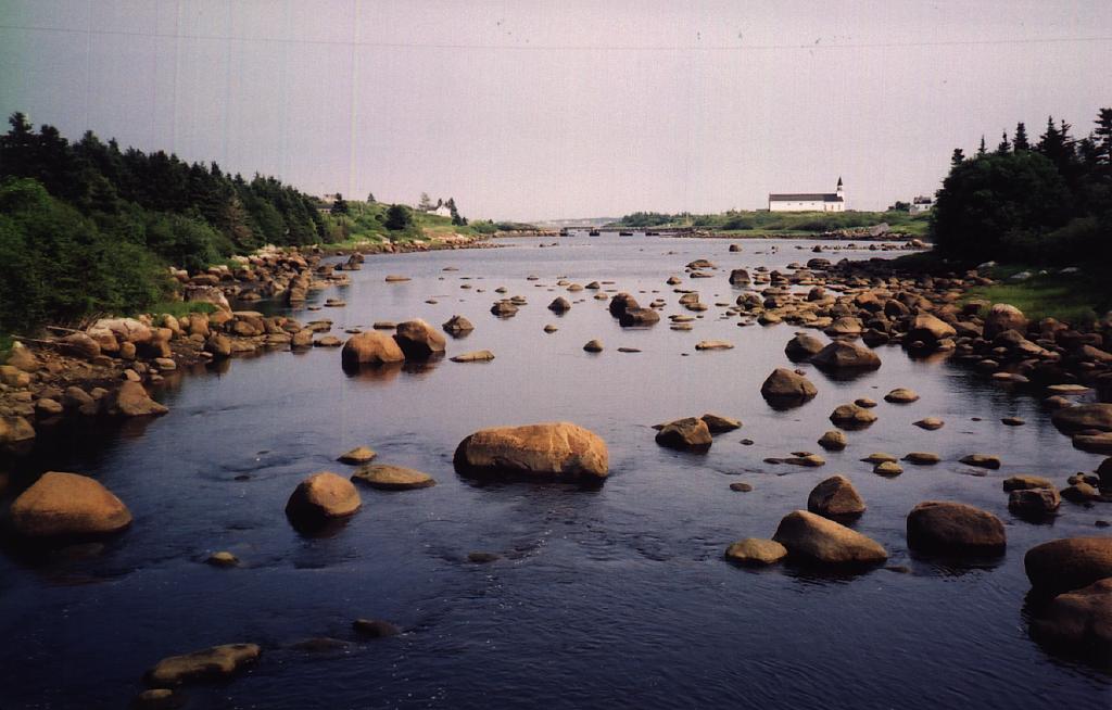
Where the highway steeply descended into Pleasant Bay, the view northward along the west coast was impressive, but the air clarity was not that suitable for a photograph, so I declined. The road then entered the fore-mentioned interior once again, and exited it up on the east coast at the hamlet Cape North near Aspy Bay. I decided to drive to the northern coast, so I ended up in Bay St. Lawrence, right near Cape Breton's northern tip, which was appropriately named "Cape North". Bay St. Lawrence was incredibly picturesque, and I took a few more photographs, some of the sea, and some of the town. I seemed to be a sucker for all the brightly coloured tied up fishing boats. It was not that busy, even considering that it was way out of the way, but I sure would put it on the highly recommended list. The town surrounded a large serene harbour, that unusually punctured the rugged and rocky northern coast.
| Bay St. Lawrence | |||
 |
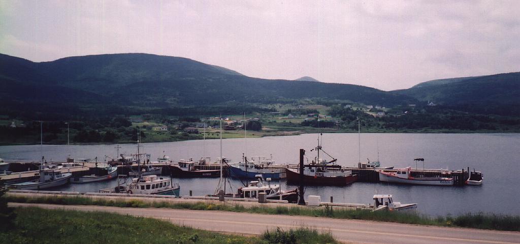 |
 |
 |
Driving back, I stopped at the Cabot Landing Provincial Park. After researching a bit before on where Cabot actually landed, I laughed, as there was no direct reference or evidence for any specific landing in Newfoundland or Nova Scotia. Individual locales seem to have differing opinions on this, however. This location had to be once of the most scenic in all Nova Scotia, and it really impressed me. Aspy Bay was bordered by long wide sandy beaches interspaced with treed islets where the estuary met the ocean. The lagoons were full of birds, and the area was rather uninhabited, so it would be a superb place to camp. The only detraction would be that the ocean temperature would not really be enjoyable.
On sure way to tell when you're in the sticks, is when quads are racing around on the roads, and two buddies on a quad were on my tail, driving down the road, for several kilometres. This was not that uncommon in Nova Scotia, as I may have seen five people driving their quads on public roads over the weekend. I would imagine that the police don't really care.
After taking the short scenic route around the coast, I passed thorough Neil's Harbour just before re-joining the Cabot Trail. From there until the park exit at Ingonish, the road was through thick forest. The bay around Ingonish was pretty, and there seemed to be plenty of hotels, so I would recommend staying there, rather than on the opposite gulf side, where the tourist accommodations were very sparse.
After travelling down the coast, I decided that I would venture into Baddeck, for if nothing else, to see the Bell stuff, so I bypassed the ferry at St. Ann's Bay by driving inland, where I met the TCH (Trans Canada Highway) at South Gut St. Ann's. The TCH was straight, level, and wide, just the type of highway that I tried to avoid, so I exited left as soon as I could onto the rural road into Baddeck. I was then first able to see the one channel of Bras d' Or Lakes, which were about 1600 sq. km. A few minutes later, I entered Baddeck, and I ventured up the hill to visit the Alexander Graham Bell museum. The museum was critically SOS, and considering the massive building and site, and apparent legacy he left, the displays were sorely lacking. I did check out the cute museum guide, and the big recreated hydrofoil, which was the only sizable exhibit, and then left wondering why they were not exhibiting and describing more.
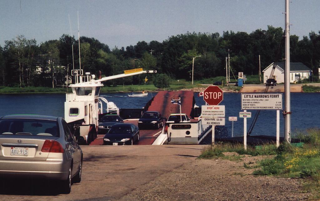 Exiting Baddeck into a small chubasco along the TCH, I drove south for half an hour to Little
Narrows where I could circumnavigate the lakes. I ended up at another small cable ferry which only
took about five minutes and five dollars to cross the narrow channel. After departing the ferry,
the bumpy road then joined the island's railway line and took me along the shore, where I could view
the Bras d'Or Lake's central expanse. I passed right by the Celtic centre, and onto a large bridge
at Grand Narrows. I was reading earlier that the railway may be abandoned, as the traffic had
significantly curtailed since coal's demise on C.B. I thought that the drive up the lake's eastern
shore would be a lot more scenic, but most the way was obscured by bush. At the north end, I
journeyed through some country roads, and then once again rejoined the TCH near the North Sydney to
Newfoundland ferry terminal. I departed the TCH left to circumnavigate the whole Sydney Harbour
along the coastal road starting in Sydney Mines. The towns didn't look that dilapidated,
considering how much the local economy must have shrunk. Sydney itself had a big eyesore in the
former steel mill and slag piles, but that was all being dismantled and cleaned up. Downtown Sydney
had several larger nice hotels, but I had already decided that Glace Bay would be a good destination
for the day. After leaving the nice little community of New Waterford, I traveled past a huge
abandoned federal coal mine, and then past the big Lingan power plant. I sure could see how dirty
the local coal was, as the plume had visible sulphur emissions. Lingan Bay would be much nicer if
it were not adjacent to heavy industry. Stopping at Glace Bay was good in theory, but it had
absolutely nowhere to stay, and there must have been some big event in the works, as the streets
were full of people travelling to a singular destination. After losing myself only once, I then got
on the proper road south to depart the town, and take a chance on accommodation in Louisbourg. By
then it was getting fairly late in the day (20:30), and I was ready to stop, so after few more
country roads, and short piece of main highway, I drove into Louisbourg
with about 570 km on the
day. I decided that the first big motel had the most potential for economical accommodation, but at
$77/night, I am not so sure it was a good deal. I did manage to find a good restaurant down the
street, though, and I had a delicious seafood supper. Most the better restaurants in Nova Scotia
were all expensive, as they catered to American tourists, so it was difficult to find an
entrée under $15.
Exiting Baddeck into a small chubasco along the TCH, I drove south for half an hour to Little
Narrows where I could circumnavigate the lakes. I ended up at another small cable ferry which only
took about five minutes and five dollars to cross the narrow channel. After departing the ferry,
the bumpy road then joined the island's railway line and took me along the shore, where I could view
the Bras d'Or Lake's central expanse. I passed right by the Celtic centre, and onto a large bridge
at Grand Narrows. I was reading earlier that the railway may be abandoned, as the traffic had
significantly curtailed since coal's demise on C.B. I thought that the drive up the lake's eastern
shore would be a lot more scenic, but most the way was obscured by bush. At the north end, I
journeyed through some country roads, and then once again rejoined the TCH near the North Sydney to
Newfoundland ferry terminal. I departed the TCH left to circumnavigate the whole Sydney Harbour
along the coastal road starting in Sydney Mines. The towns didn't look that dilapidated,
considering how much the local economy must have shrunk. Sydney itself had a big eyesore in the
former steel mill and slag piles, but that was all being dismantled and cleaned up. Downtown Sydney
had several larger nice hotels, but I had already decided that Glace Bay would be a good destination
for the day. After leaving the nice little community of New Waterford, I traveled past a huge
abandoned federal coal mine, and then past the big Lingan power plant. I sure could see how dirty
the local coal was, as the plume had visible sulphur emissions. Lingan Bay would be much nicer if
it were not adjacent to heavy industry. Stopping at Glace Bay was good in theory, but it had
absolutely nowhere to stay, and there must have been some big event in the works, as the streets
were full of people travelling to a singular destination. After losing myself only once, I then got
on the proper road south to depart the town, and take a chance on accommodation in Louisbourg. By
then it was getting fairly late in the day (20:30), and I was ready to stop, so after few more
country roads, and short piece of main highway, I drove into Louisbourg
with about 570 km on the
day. I decided that the first big motel had the most potential for economical accommodation, but at
$77/night, I am not so sure it was a good deal. I did manage to find a good restaurant down the
street, though, and I had a delicious seafood supper. Most the better restaurants in Nova Scotia
were all expensive, as they catered to American tourists, so it was difficult to find an
entrée under $15.
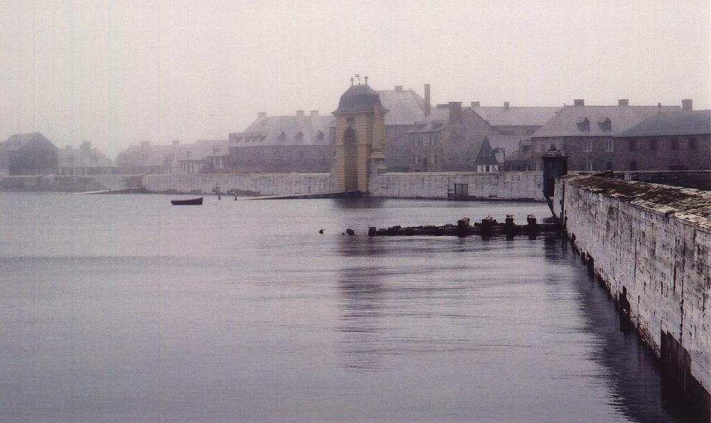
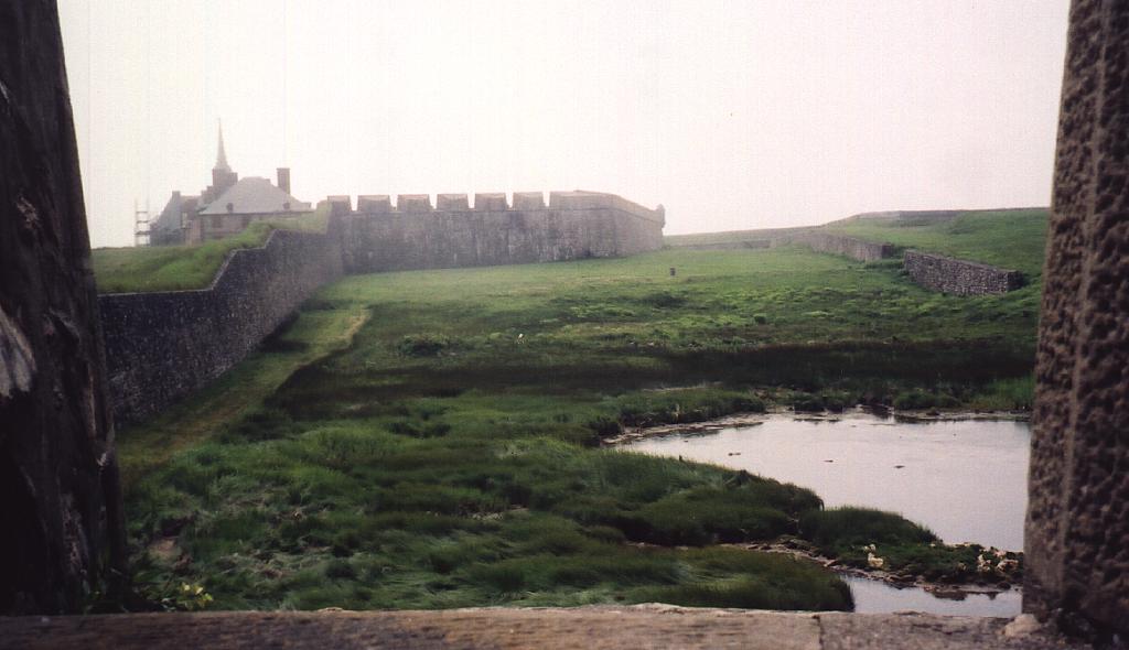
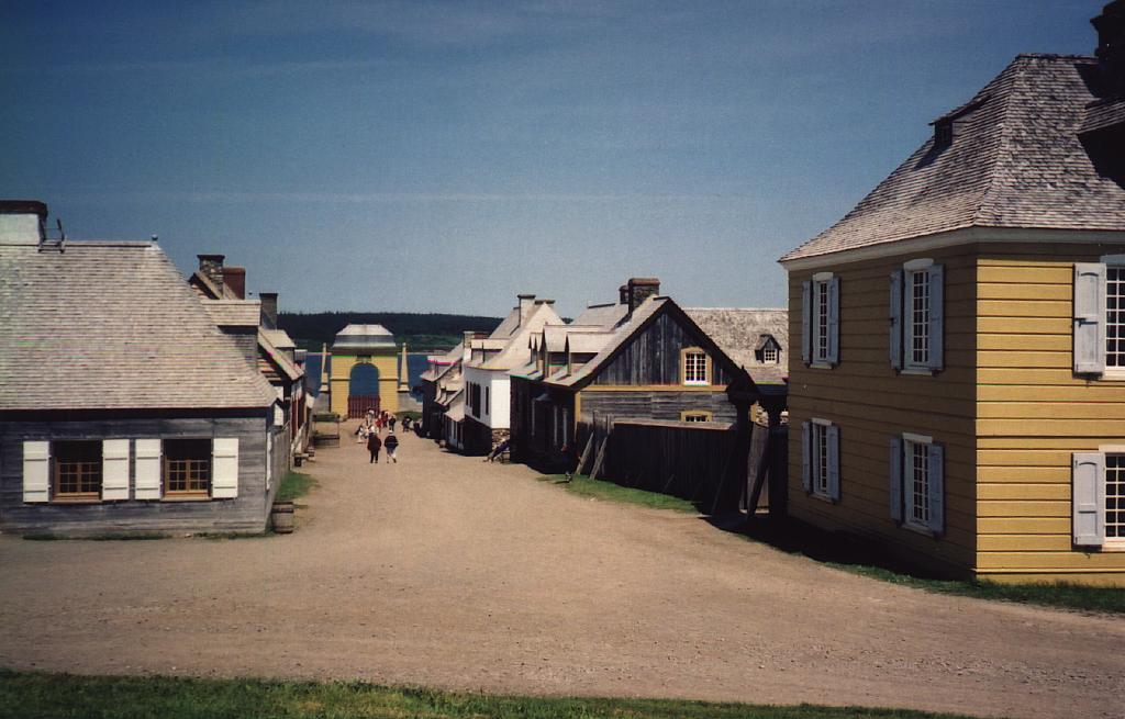
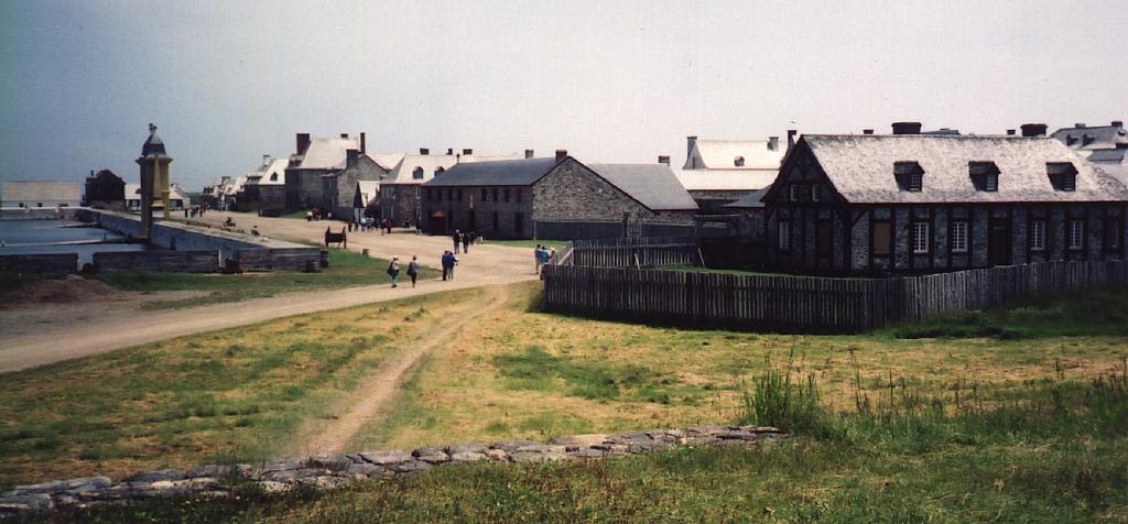
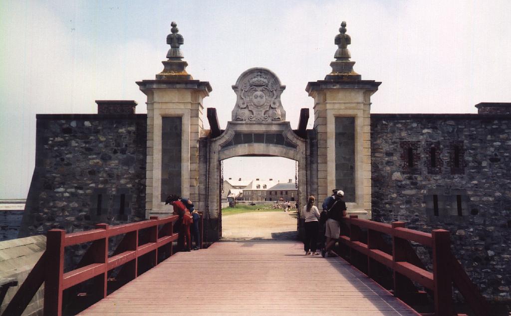
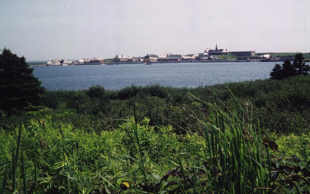
I woke up early, but the fog was really thick. So, after eating a leisurely breakfast, and finishing reading Saturday's Globe & Mail, I left about 10:30 for Fort Louisbourg. There were large parking lots, where a shuttle bus then took the ~3 km drive over to the fort. The fog was just breaking, so the whole scene was eerily surreal when I arrived, and I was able to take some interesting photographs. The fort was supposed to be about 20% rebuilt from what it was, as the British totally destroyed it after the 1760 New France treaty. The Canadian Government must have spent a fortune rebuilding it, and continued to do so for maintenance and wages. They had a whole bunch of people walking and standing around in period costumes. I gathered that this project helped replace gainful employment in the coal mines which undoubtedly costed us a lot more to subsidise. The buildings were in the most part, faithfully re-built, and the whole site was definitely a highlight, and surely not SOS. The main king's bastion building was being re-built when I was there, so the scaffolding distracted from the view, and preempted any photographs. I couldn't help but wonder why they couldn't do it right the first time. Apparently, the French used some inferior cement which necessitated enhanced maintenance, but I would have guessed that 200 years later, construction methodology would have improved. I could see that the chimneys were falling apart, and the ones that hadn't fallen down had been reinforced, and rebuilt.
| Louisbourg | ||
 |
 |
 |
 |
 |
 |
After I left the fort and the bus again, I drove back quickly along the really neat and winding gravel road to Kennington Cove, where the British had landed both times to successfully siege the fort. The second time they had thirty thousand men, so victory was almost assured, as Louisbourg had less than a thousand soldiers. It makes me wonder what purpose the fort served, and what purpose fortifications serve in general, as they have almost always been circumvented. For all the money the French had put into Louisbourg's fortifications and defenses, they never were worth a dime.
After leaving Louisbourg, I filled up with gas at Albert Bridge, and headed south along the Mira
river, which was more like a long lake. I then visited the olde towne of Gabarus (1616), and then
headed south along the Fleur de lis Trail. Where the road had been getting very rough, all of a
sudden it was newly paved, and probably the best road in all of Cape Breton. It stayed that way all
along the sparsely inhabited coastal wetlands down to Grand River, where I temporarily left the
road, to venture nearer the coast. That was a good move, as I was able to see Point Michaud Beach,
 which was one of the widest and longest that I had seen in Nova Scotia. I was almost tempted to
wade in, when I thought that the water was probably even less than the 11 Celsius down south. So, I
got back in the car, and drove back towards the Canso Straight. The Acadian countryside became more
rural and picturesque, and near River Bourgeois, became even more so.
which was one of the widest and longest that I had seen in Nova Scotia. I was almost tempted to
wade in, when I thought that the water was probably even less than the 11 Celsius down south. So, I
got back in the car, and drove back towards the Canso Straight. The Acadian countryside became more
rural and picturesque, and near River Bourgeois, became even more so.
I then figured that I had time to drive around Isle Madame, so I saw the quaint towns of Arichat and West Arichat, then headed off the island and causeway back onto the main highway 104 to expedite my return to Dartmouth. I drove off Cape Breton Island and over the causeway at 18:15, and I decided that if I could be back in Dartmouth before 20:40, then I would eat at the hotel. I drove more or less 120 km/hr all the way on mostly divided highways, through New Glasgow and Truro, and ended up back at my motel at 20:35, so after driving 660 km that day, and 1700 km in three days, I was able to have my last haddock supper in Nova Scotia.