Autopista Oaxaca-Puerto (2015-07-09 new profiles)
Select image thumbnail for large WWW version

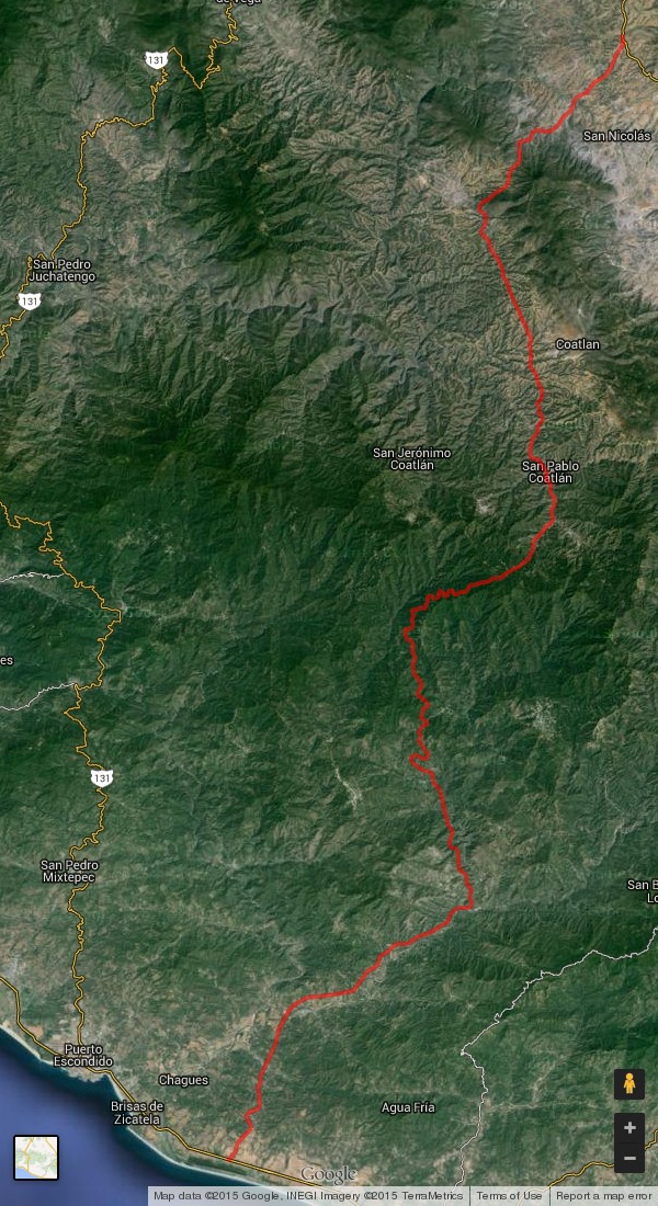
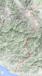
autopista-sat-1 (600x1100 240 KB)
|
autopista-terra-1 (600x1100 280 KB)
|
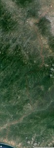
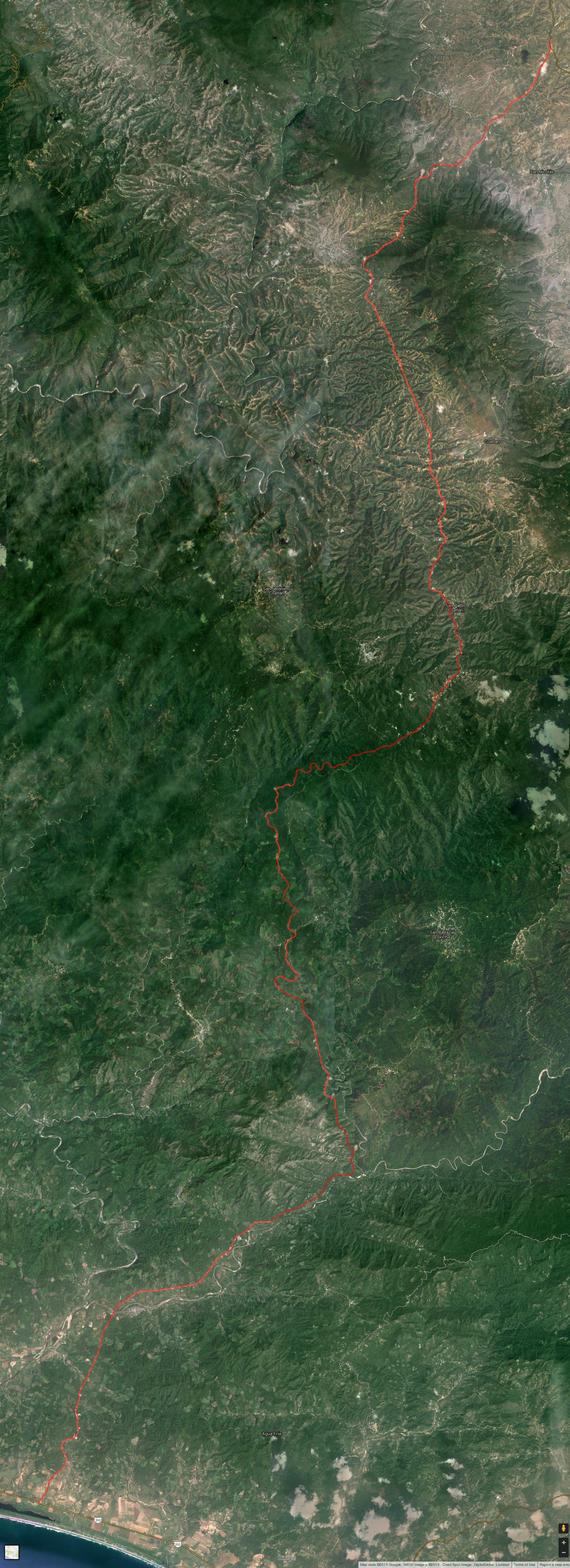
autopista-sat-2 (1600x4400 2 MB)
|
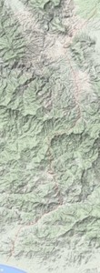
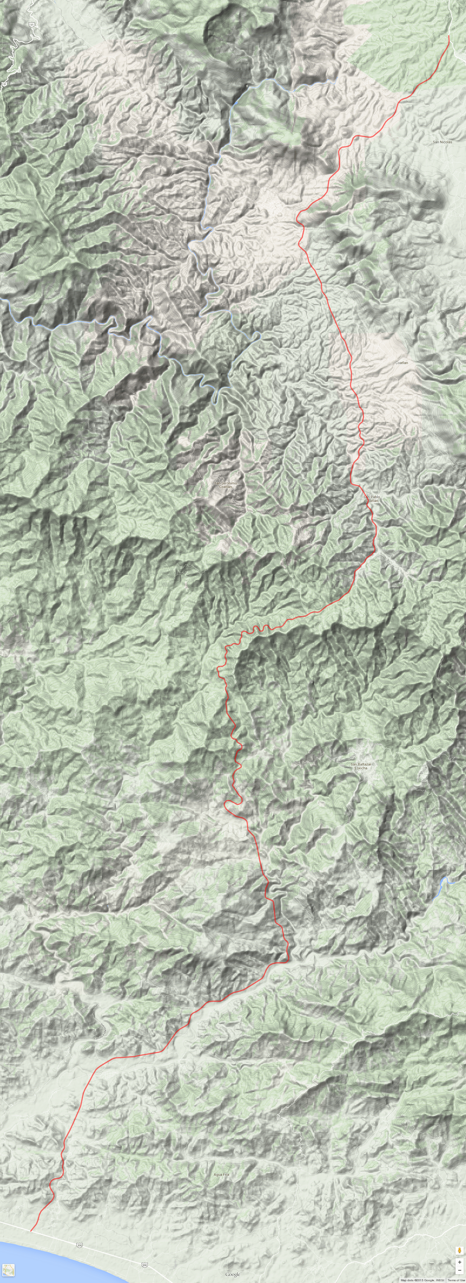
autopista-terra-2 (1600x4400 4.1 MB)
|
Google Maps Autopista Route
These different maps show the route for the new autopista from Oaxaca to Puerto Escondido which is
now being constructed. The left two maps are smaller scale and the right two are larger scale and
are correspondingly much bigger. The left maps show a satellite view, and the right maps show a
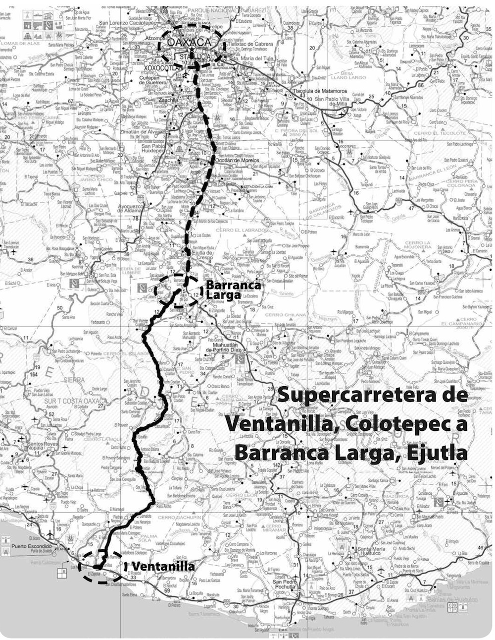
terrain view. The page bottom left image gives the general route alignment and reference to
surrounding communities. The existing road from Oaxaca to Barranca Larga, which is being upgraded,
is not shown on the above maps.
Google Maps KML File
Check out the Oaxaca Carretera KML File. (Views on Map-Terrain to help
understand why it will not be done this decade.)
[The middle section now is largely visible with
construction and clearing. I realigned the route with with the satellite image, as the whole thing
seemed majorly misaligned, which was definitely not the case with the south and north sections. I
guessed that the original road map was probably more faulty than Google Map.]
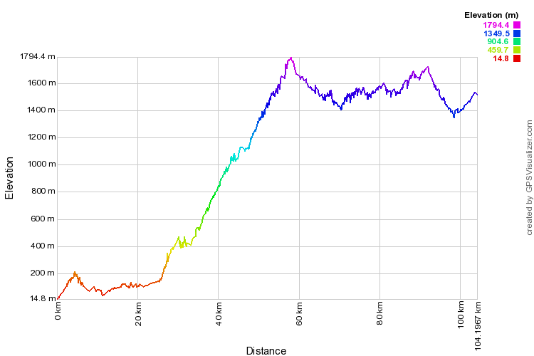
Elevation and Gradients
I spent an inordinate amount of time (again!) working on the elevation plots. As you may notice,
there is a steep grade up the mountains, a steady 5% for 30 km. There is an excellent site which makes elevation charts and plots from coordinate data. Their elevation chart (below centre) is neat, but it logically follows
the terrain. I tried several linear filters to even out the road gradient, but the results were not
good. I finally tried first order linear regression on 11 points (5 before & 5 after) which worked
wonderfully. This should be much closer to reality, although I imagine there are still significant
deviations. The PDF charts are linked below right.
WGS-84 Distance Correction
I also luckily found a Matlab
WGS84 function: function s = vdist(lat1,lon1,lat2,lon2)
% VDIST - compute
distance between points on the WGS-84 ellipsoidal Earth
% to within a few millimeters of
accuracy using Vincenty's algorithm
By transcribing this function to Rexx, I adapted the
coordinate distance calculations to to WGS84, which surprisingly added 1.5 km (2B checked) to the
autopista length. I also thought the gradient angle might make more difference, but it didn't. As
a first approximation for the principal 30 km rise:
|X,Y,Z| =
|30000,1500| -> sqrt(30000**2+1500**2)-30000=37.47. So, a 1500 m rise over 30 km
would only be 37 m longer, which correlates adequately to the actual 90 m difference.
|
Calculations (km)
|
Linear
|
WGS84
|
WGS84 + Grade
|
|
Straight Route
|
79.331
|
79.326
|
79.340
|
|
Actual Route
|
104.220
|
105.777
|
105.860
|
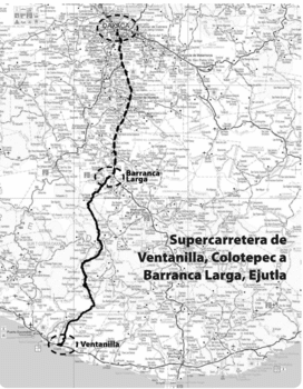
Route map (1000x1291 600 KB)
|
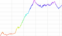
gpsvisualizer profile (750x500 24 KB)
|
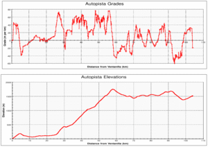
Autopista profile & grade (PDF 30 KB)
|